MODIS (Spectroradiometer)
Enlarge text Shrink text-
 Topic
Topic


- Work cat.: Schuetz, Andrea M. Overestimation of cloud cover in the MODIS cloud product, 2007.
- Wikipedia, accessed June 28, 2007(MODIS (Moderate-resolution Imaging Spectroradiometer) is a payload scientific instrument launched into Earth orbit by NASA in 1999 ... the instruments image the entire Earth every 1 to 2 days. They are designed to provide measurements in large-scale global dynamics including changes in Earth's cloud cover, radiation budget and processes occurring in the oceans, on land, and in the lower atmosphere)
- Goddard DAAC (Goddard Space Flight Center) Moderate-resolution imaging spectroradiometer (MODIS) : data from the Goddard DAAC, 1999.
- Goddard Space Flight Center. MODIS : moderate resolution imaging spectroradiometer, 1995.
- Seemann, Suzanne. MODIS atmospheric profile retrieval algorithm theoretical basis document, 2006.
- Google, Aug. 6, 2007(320,000 hits for Moderate-resolution imaging spectroradiometer; 3,500,000 hits for MODIS)


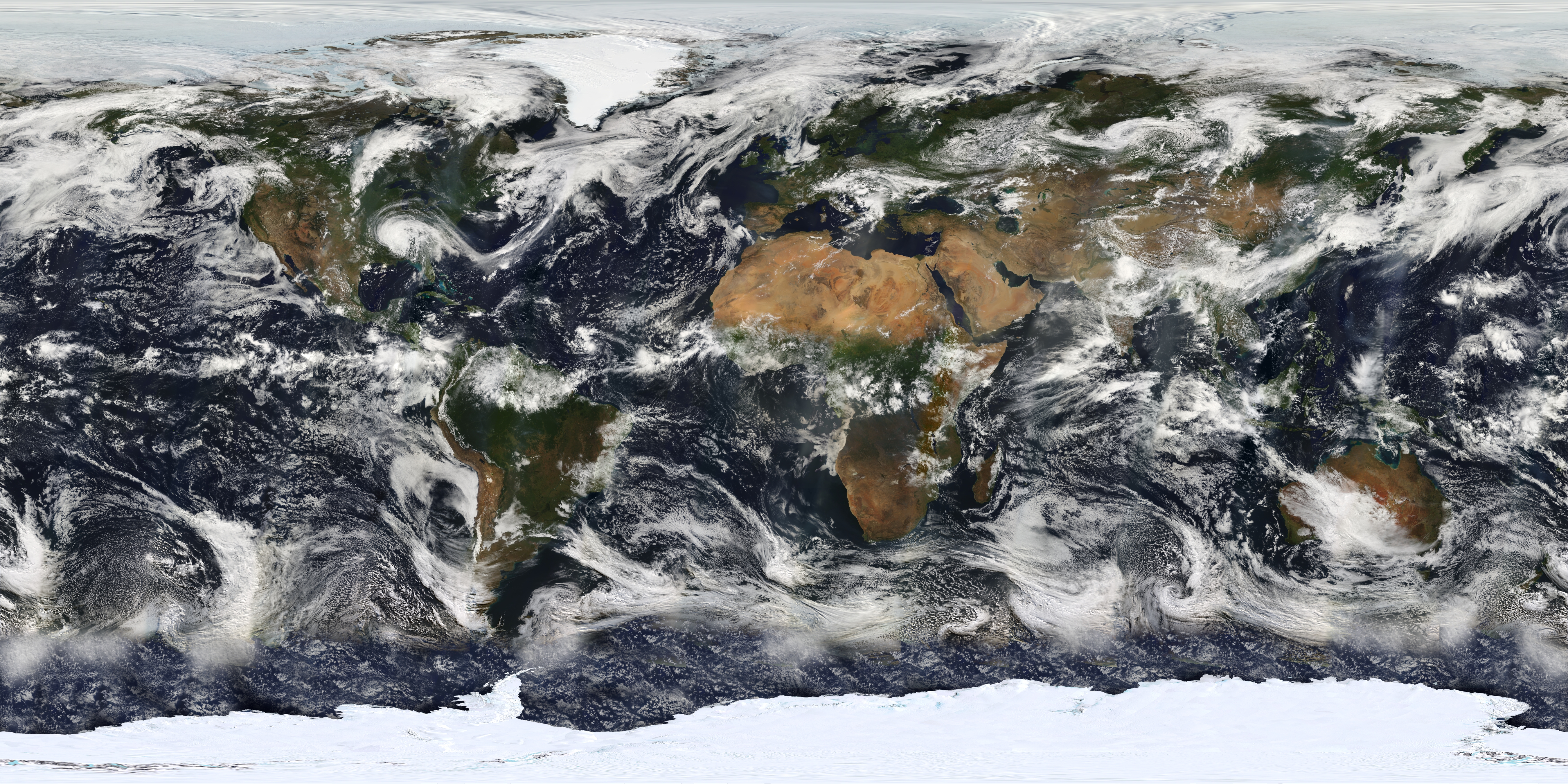


The Moderate Resolution Imaging Spectroradiometer (MODIS) is a satellite-based sensor used for earth and climate measurements. There are two MODIS sensors in Earth orbit: one on board the Terra (EOS AM) satellite, launched by NASA in 1999; and one on board the Aqua (EOS PM) satellite, launched in 2002. Since 2011, MODIS operations have been supplemented by VIIRS sensors, such as the one aboard Suomi NPP. The systems often conduct similar operations due to their similar designs and orbits (with VIIRS data systems deisgned to be compatible with MODIS), though they have subtle differences contributing to similar but not identical uses. The MODIS instruments were built by Santa Barbara Remote Sensing. They capture data in 36 spectral bands ranging in wavelength from 0.4 μm to 14.4 μm and at varying spatial resolutions (2 bands at 250 m, 5 bands at 500 m and 29 bands at 1 km). Together the instruments image the entire Earth every 1 to 2 days. They are designed to provide measurements in large-scale global dynamics including changes in Earth's cloud cover, radiation budget and processes occurring in the oceans, on land, and in the lower atmosphere. Support and calibration is provided by the MODIS characterization support team (MCST).
Read more on Wikipedia >