Tunis, Gulf of (Tunisia)
Enlarge text Shrink text-
 Place
Place
|
מספר מערכת
987007539649505171

Information for Authority record
Name (Hebrew)
מפרץ תוניס (תוניסיה)
Name (Latin)
Tunis, Gulf of (Tunisia)
Other forms of name
Golfe de Tunis (Tunisia)
Gulf of Tunis (Tunisia)
Khalīj Tūnis (Tunisia)
See Also From tracing topical name
Bays Tunisia
MARC

MARC
Other Identifiers
Wikidata:
Q1143820
Library of congress:
sh 96001093
Sources of Information
- Work cat.: U.S. Defense Mapping Agency. Hydrographic/Topographic Center. Tunis and approaches, 1995:map recto (Golfe de Tunis, Tunisia)
- Lippincott(Tunis, Gulf of)
- Times atlas(Tunis, G. de; gulf; Tunisia)
- Web. geog.(Tunis, Gulf of; inlet of Mediterranenan Sea, NE coast of Tunisia)
- BGN gaz. for Tunisia(Tūnis, Khalīj)
1 / 2
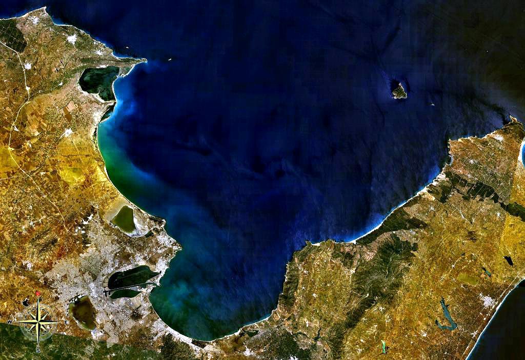
File:Gulf of Tunis NASA.jpg
, Public domain
File:Waves in pacifica 1.jpg
Brocken Inaglory, CC BY-SA 4.0
Wikipedia description:
The Gulf of Tunis (Tunisian Arabic: خليج تونس) is a large Mediterranean bay in north-eastern Tunisia, extending for 39 miles (63 km) from Cape Farina in the west to Cape Bon in the east. Tunis, the capital city of Tunisia, lies at the south-western edge of the Gulf, as have a series of settled places over the last three millennia. Djebel Ressas rises to 795 metres (2,608 ft) around 15 kilometres (9.3 mi) south of the southern edge of the Gulf. The central part of the gulf, corresponding to the city of Tunis, is favorable to the implementation of a commercial port due to its location of being a well protected area. The famous city of Carthage was built on the gulf shores.
Read more on Wikipedia >