Lower Hutt (N.Z.)
Enlarge text Shrink text-
 Place
Place


- Universal business directory for Wellington, Hutt [and] Petone.
- BGN 10/5/89(Lower Hutt, city, 41p0s13ʹS, 174p0s55ʹE (ADMI))
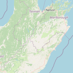
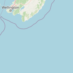


Lower Hutt (Māori: Te Awa Kairangi ki Tai) is a city in the Wellington Region of New Zealand. Administered by the Hutt City Council, it is one of the four cities that constitute the Wellington metropolitan area. It is New Zealand's sixth most populous city, with a population of 115,500. The total area administered by the council is 376.4 km2 (145 sq mi) around the lower half of the Hutt Valley and along the eastern shores of Wellington Harbour, of which 78.54 km2 (30 sq mi) is urban. It is separated from the city of Wellington by the harbour, and from Upper Hutt by the Taita Gorge. Lower Hutt is unique among New Zealand cities, as the name of the council does not match the name of the city it governs. Special legislation has since 1991 given the council the name "Hutt City Council", while the name of the place itself remains "Lower Hutt City". This name has led to confusion, as Upper Hutt is administered by a separate city council, the Upper Hutt City Council. The entire Hutt Valley includes both Lower and Upper Hutt cities. Lower Hutt is also often simply called "the Hutt".
Read more on Wikipedia >