Walnut Grove (Calif.)
Enlarge text Shrink text-
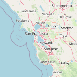
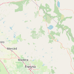
 Place
Place
|
מספר מערכת
987007562412205171

Information for Authority record
Name (Latin)
Walnut Grove (Calif.)
Coordinates
-121.512 -121.512 38.2436 38.2436 (gooearth )
W1213042 W1213042 N0381432 N0381432 (geonames )
Associated country
United States
MARC

MARC
Sources of Information
- Costello, J.G. Rice bowls in the delta, 1987:CIP t.p. (Walnut Grove, California)
- Rand McNally comm. atlas, 1985(Walnut Grove, Calif.)


Wikipedia description:
Walnut Grove is a census-designated place (CDP) in Sacramento County, California, United States. It is part of the Sacramento-Arden-Arcade-Roseville Statistical Area. The population was 1,542 at the 2010 census, up from 669 at the 2000 census.
Read more on Wikipedia >