Gaurishankar Conservation Area (Nepal)
Enlarge text Shrink text-
 Place
Place
|
מספר מערכת
987012403860505171

Information for Authority record
Name (Latin)
Gaurishankar Conservation Area (Nepal)
Other forms of name
Gaurīśaṅkara Saṃrakshaṇa Kshetra (Nepal)
See Also From tracing topical name
National parks and reserves Nepal
Natural resources conservation areas Nepal
MARC

MARC
Other Identifiers
Wikidata:
Q5527796
Library of congress:
sh2020012263
Sources of Information
- Work cat: Annual report, 2018/2019:t.p. (Gaurishankar Conservation Area) frwd. (The Government of Nepal, through a Nepal Gazette notice dated July 19, 2010 (Section, 60, number 14, Part r; 2067/04/03 VS.) entrusted the management responsibility of Gaurishankar Conservation Area (GCA) to the National Trust for Nature Conservation for a period of 20 years.)
- English page (Gaurishankar Conservation Area covers an area of 2,179 square kilometers and encompasses 22 Village Development Committees of 3 districts. The Government of Nepal has entrusted the management responsibility of Gaurishankar Conservation Area to the National Trust for Nature Conservation (NTNC) for 20 years.) Nepali page (name: Gaurīśaṅkara Saṃrakshaṇa Kshetra ( (Department of National Parks Wildlife Conservation, Ministry of Forests and Environment, Government of Nepal (website), viewed December 18, 2020) )
1 / 4

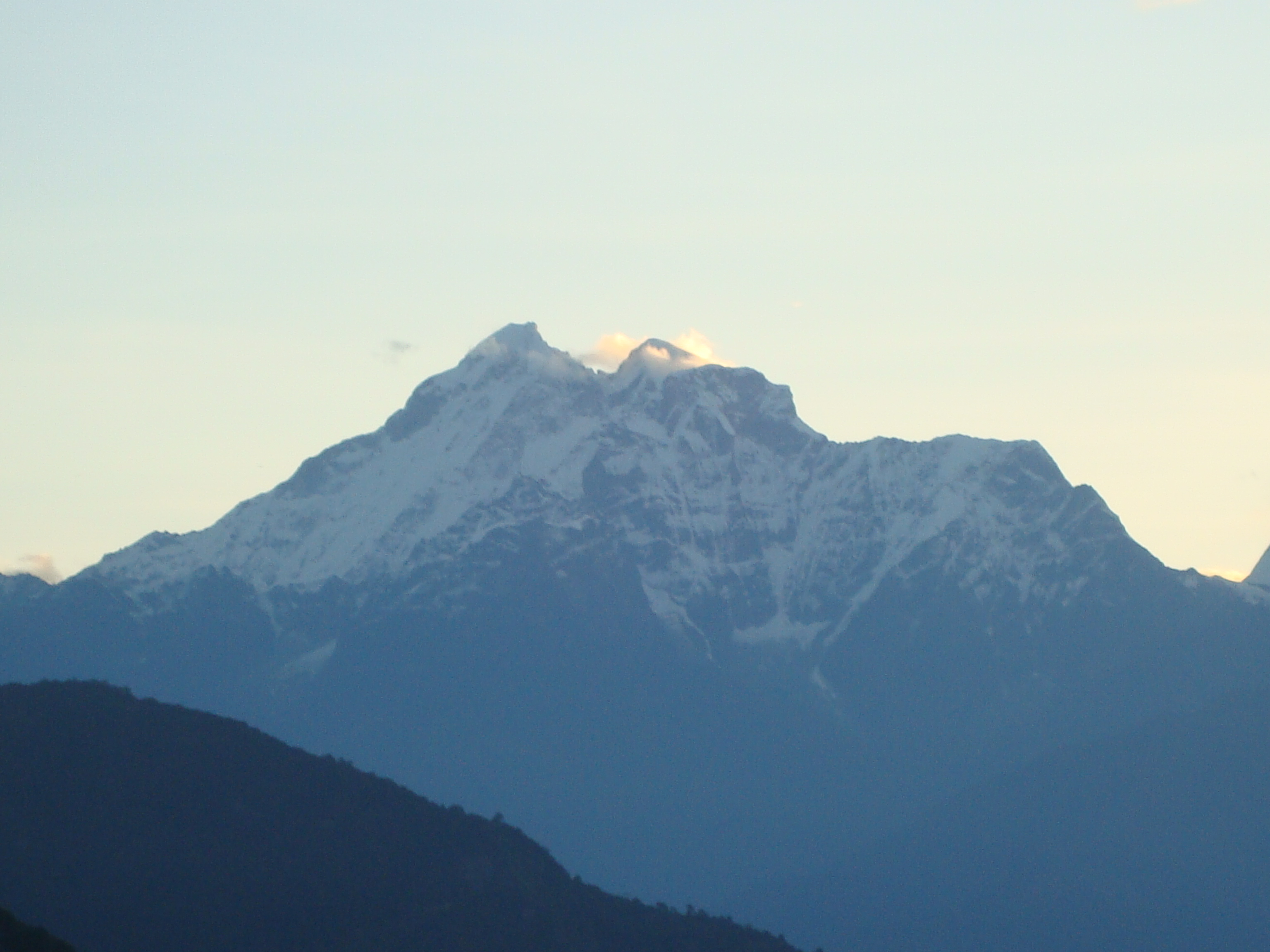
Gaurishankar himal
Sankustha, CC BY-SA 4.0
File:Gaurishankar Himal.jpg
Thehimalayanhealer, CC BY-SA 3.0

File:Kalinchowk (3780 m) (3306554742).jpg
Dhilung Kirat from Santa Barbara, CA, CC BY 2.0

File:Waterfall inside gauri shankhar conservation area.jpg
Joshan basnet12, CC BY-SA 4.0
Wikipedia description:
Gaurishankar Conservation Area is a protected area in the Himalayas of Nepal that was established in January 2010, covering 2,179 km2 (841 sq mi) in the Ramechhap, Dolakha and Sindhupalchok districts and encompassing 22 Village Development Committees. It is contiguous with Tibet in the north and a part of the Sacred Himalayan Landscape. The protected area connects the Langtang and Sagarmatha National Parks. In 2010, the Government of Nepal handed over the management of Gaurishankar Conservation Area to National Trust for Nature Conservation for 20 years, which has been managing the area through its Gaurishankar Conservation Area Project.
Read more on Wikipedia >